On March 28, 2023, The Piedmont Environmental Council hosted a local information session in Loudoun County about a variance being proposed by The Virginia Department of Environmental Quality to allow Loudoun data centers to use their backup diesel generators more frequently during the coming summer.
Planning and Zoning
PEC believes in smart growth planning and decision-making that enhances communities, reduces vehicle miles traveled, and protects natural, cultural and historic resources.
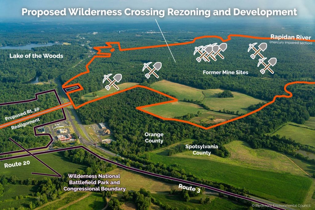
March 23: Public Hearing on Wilderness Crossing
It is critically important that County decisionmakers hear from you before they vote on this impactful proposal.

Planning Commission Public Hearing on Wilderness Crossing Set for March 23
Even after 18 months, it is still unclear what the applicant has planned for the 2,618 acres of land included in the Wilderness Crossing rezoning proposal — still unremediated of toxic hazards from historic gold mining activities. The details have continued to change, and most recently, the number of homes has been reduced from 6,500 to 5,000 while the industrial square footage has increased by almost five times. Additionally, a variety of industrial uses, including data centers and warehouse/distribution centers, would now be allowed by-right.
The Planning Commission recently held its fifth and final work session for Wilderness Crossing on March 2, which means the application is now headed to a public hearing on Thursday, March 23, 2023.

Reminder: Amazon data center hearing Feb. 14
Just a quick reminder that the Warrenton Town Council is scheduled to hold a public hearing on the proposed Amazon data center Special Use Permit application next Tuesday, Feb. 14, 2023 at the Fauquier High School Auditorium.
Jan. 10 Town Council Public Hearing on Amazon Data Center
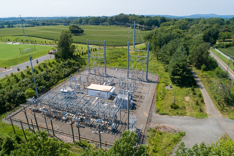
On Tuesday, Jan. 10, the Warrenton Town Council will conduct a public hearing on the proposed Amazon data center at the gateway to Warrenton on Blackwell Road.
Town Hall Meeting Will Provide New Information Surrounding Proposed Warrenton Amazon Data Center
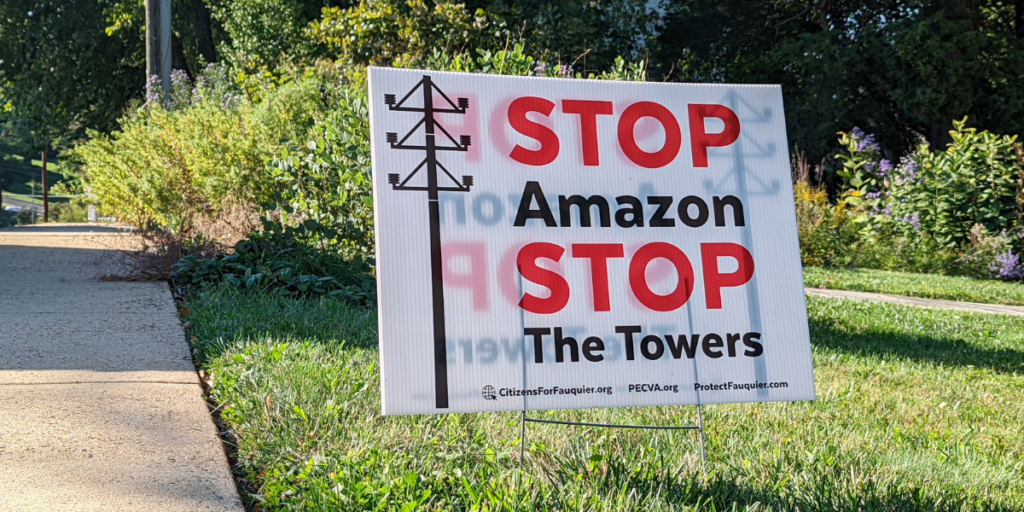
On Wednesday, Oct. 26, Citizens for Fauquier County, The Piedmont Environmental Council and Protect Fauquier will host a town hall event to explore the myths and realities of Amazon’s proposed Blackwell Road data center in Warrenton.

Join us for an Amazon data center town hall next Wednesday, Oct. 26
Given the positive feedback on our last town hall, Protect Fauquier, Citizens for Fauquier County, and PEC have decided to hold another meeting on the proposed Amazon data center.
Takeaways from the recent Warrenton Amazon Data Center Balloon Test
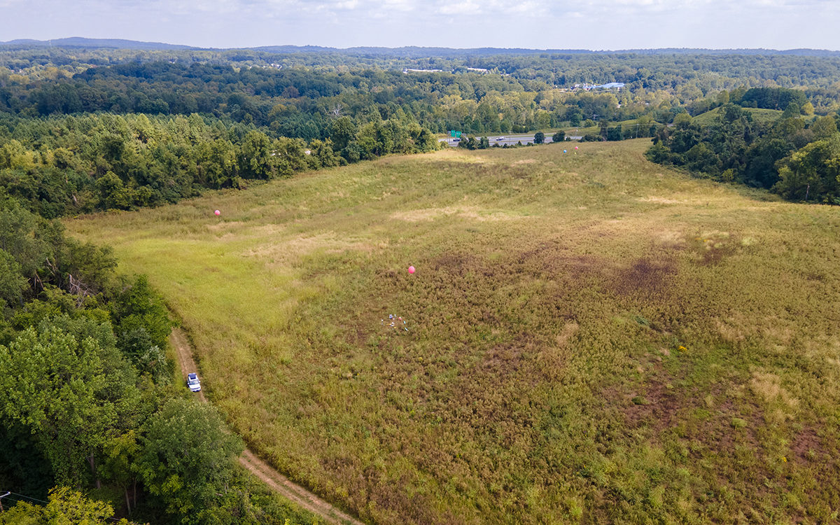
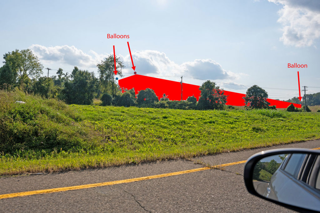
By now, you’ve probably read about the balloon test conducted by Wetland Studies and Solutions, Inc. for the proposed Amazon data center on Blackwell Road last Thursday, Sept. 15. If you had to travel to/from Warrenton on U.S. Route 17 or 15/29 Business or were at a number of different locations in Town you might have even seen the balloons themselves.
Here are photos/renderings of what we saw that day:

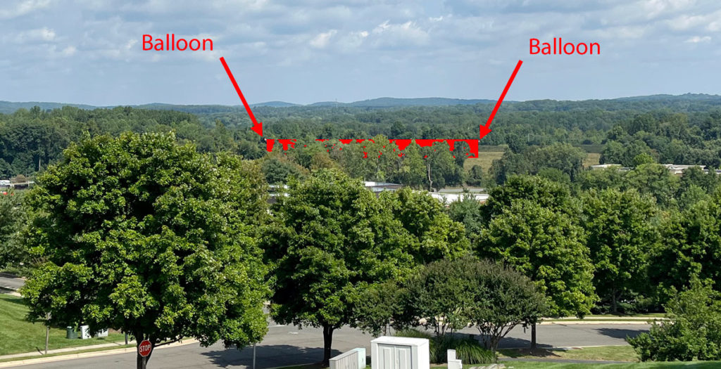
See all of the photos captured that day >>
The balloons may have been placed at the corners of the proposed 220,000-square-foot and 37-foot-high Amazon data center, but as you can see in the drone shot, two of the four balloons were quite close to each other. So it’s not clear whether that was true or not. While the balloon locations are a good starting point for determining the visual impact of the proposed data center, we should all be aware that they do not provide the full picture.
For instance, Amazon’s latest submission to the Town on September 9 failed to provide details on how the height of the balloon test was determined. Thus, we’re not sure if the height of the balloons accurately reflected all building elements that were detailed in that same submission. Amazon’s architects indicated that with the inclusion of a parapet wall (an extension of the wall at the edge of a roof) and other rooftop equipment, the tallest point of the building could reach just under 57 feet — 20 ft above the height of the building itself. It’s unclear if the balloons were at a height closer to 37 or 57 feet.
Additionally, the four balloons cover just a tiny fraction of the surface area of the proposed 220,00- square-foot building — only the outer corners of what would be filled in by the building — and the location of each of the balloons was influenced by the wind that day.
Most importantly, the balloon test did not include the removal of trees as proposed in the Tree Study prepared by Amazon’s representatives and included in the September 9 submission (see page 13) that shows substantial tree removal, particularly at the northern and western edges of the property, some of the most visible portions of the site to adjacent neighborhoods and Rt. 17.
Despite these limitations, the balloons were still visible from a number of different vantage points in Town. We prepared a viewshed analysis of the 37-foot data center building and presented this map to the community at our August 10 Town Hall. The analysis utilizes LiDAR data that encompasses current groundcover and topography to predict how visible the 37-foot elevation of the building would be within a 3-mile x 3-mile square.
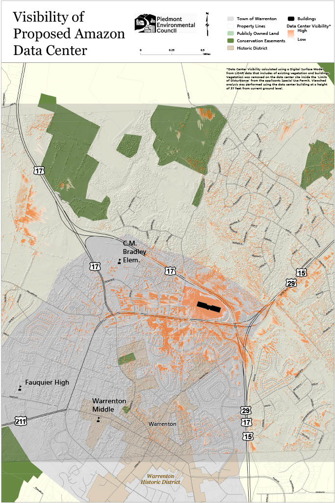
As we predicted, the balloons were visible from many of the areas we highlighted in red on our viewshed map, confirming the accuracy of our analysis. Again, it’s likely that the visual impacts are understated given the limitations of the balloon test.
This new information is all the more reason residents should come out and voice their concerns about the detriment this proposal will have on quality of life in the Town and County, including visual impacts of the data center on Warrenton’s gateway, numerous locations in Town, and the rural character that draws visitors and residents alike to this area.
Finally, the coalition, Citizens for Fauquier County, Protect Fauquier, and PEC, plan to hold another town hall on October 26 at the Highland School.
The Amazon Data Centers: Myths and Realities
Highland School Auditorium
597 Broadview Avenue, Warrenton, Virginia 20186
October 26, 2022 @ 7 – 9 p.m.
Come out to learn more about the Amazon data center proposals and the impact they could have on the Town of Warrenton and the County! We’ll also be sharing the actions you can take to oppose this proposal as we get closer to the Planning Commission’s decision.
Please don’t hesitate to reach out to PEC’s Fauquier Field Representative, Kevin Kask, with your thoughts or questions. He can be reached at [email protected] and (540) 347-2334 ext. 7046.

Albemarle to Host Climate Resilience Planning Event
Join Albemarle County for a discussion of the main conclusions of the Climate Vulnerability and Risk Assessment report, published in June 2022, and an overview of the next steps in building resilience as a community and local government.
The event will begin with an overview of the report’s key takeaways, followed by a panel discussion by local experts to help make sense of these themes within the daily lives of community members. It will close with an outline of next steps in preparing for resilience, including our community engagement process to help develop a climate adaptation resilience plan.
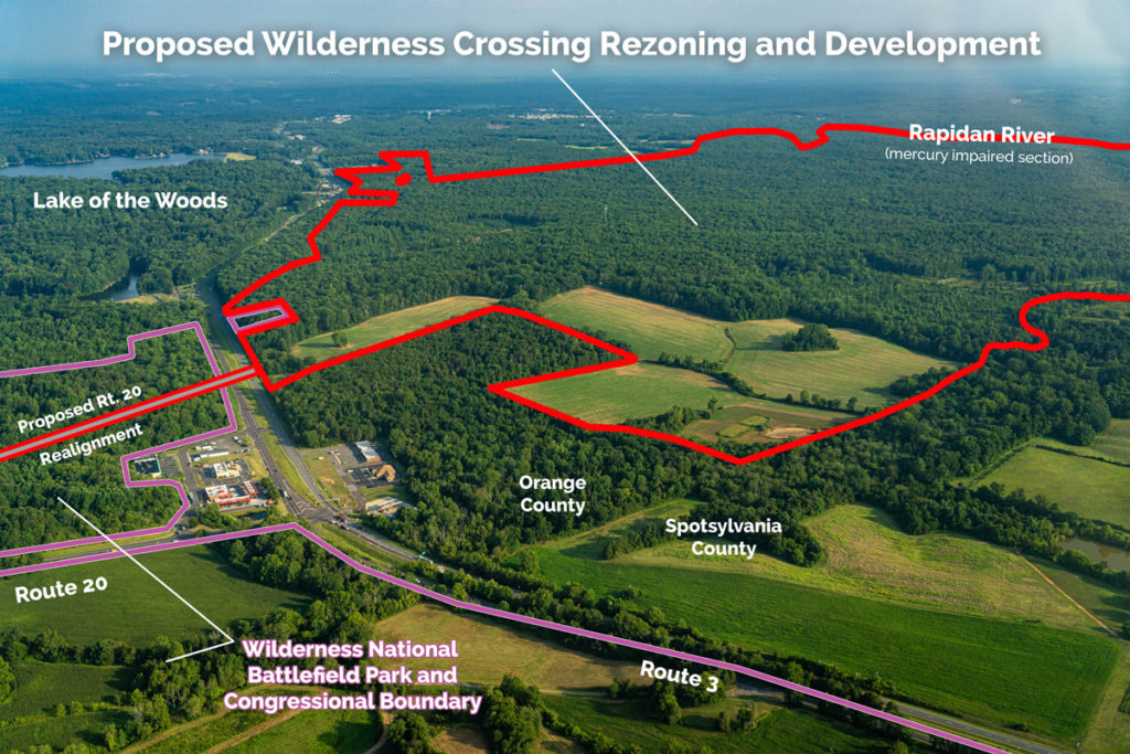
Wilderness Crossing is Back
I’ve been monitoring the project for several months, as it has slowly made its way through the county application process. Now, the developer is finally holding a community briefing, and I want to make sure the word gets out.

